Read the landscape
Explore detailed topographic maps with contour lines and terrain shading. Add Waymarked Trails overlays for hiking and cycling, and choose from multiple base maps.
 OpenTopoMap VIEWER FOR ANDROID
YOUR NEXT ADVENTURE STARTS HERE
The detail of a topographic map.
The freedom to make your own way.
Explore paths, open your GPX tracks and keep the places that matter close at hand. OpenTopoMap Viewer brings it all to your Android phone.
Open source · Made for Android · Ad-free FOSS builds available
01 / EXPLORE WITH CONTEXT
See the terrain, the trails and the places along the way. Bring your own route, or start with a place you want to reach.
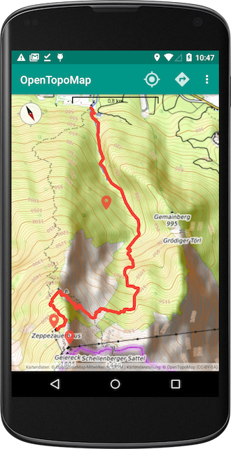
Explore detailed topographic maps with contour lines and terrain shading. Add Waymarked Trails overlays for hiking and cycling, and choose from multiple base maps.
Open GPX tracks, routes and waypoints. Inspect distance and elevation profiles, choose your track colour and keep the route in view as you explore.
Save markers with names, colours and labels. Discover nearby Wikipedia places, or use your markers as waypoints for route planning.
Place search and route planning are powered by OpenRouteService and require your own ORS API key and an internet connection. Choose walking, hiking, cycling and other routing profiles.
A LOOK ALONG THE WAY
Real views from the app, from the first turn to a closer look at the climb ahead.
Follow your track through a landscape full of detail.
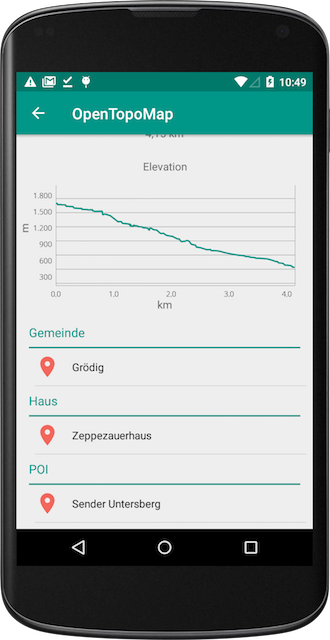
Check the track details and inspect the elevation profile.
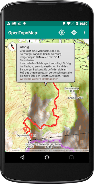
See waypoint information without losing your place.
Screenshots show an earlier app version. The current interface may differ.
02 / PREPARE BEFORE YOU GO
Download a regional OpenTopoMap tile package before you head out, then import it into the app’s map cache.
READY-MADE PACKAGES: EUROPE
Browse offline maps Missing a European region? Request a package ↗Choose a package from the catalogue and save the ZIP to your phone. Keep it zipped.
In the app, open Settings → Cache → Import offline tiles and select your ZIP.
Under Settings → Screen, set OpenTopoMap tile source to OpenTopoMap (Archive/Preloaded). Select OpenTopoMap in Layers.
Pan to the region and test the included zoom levels in airplane mode. Routing and search still need internet.
Configure cache settings before importing. Clearing the map cache also removes imported tiles; keep the original ZIP.
03 / TAKE IT WITH YOU
Choose where you get OpenTopoMap Viewer.
BUILT IN THE OPEN
OpenTopoMap Viewer is an independent, open-source Android project by Serge Helfrich. Feedback, bug reports and contributions help it grow.
Support development on Ko-fi